The ever soothing treefrog lullaby was that more soothing to the nerves after the previous hours of battering. Who was to foresee that it was about to get even worse?
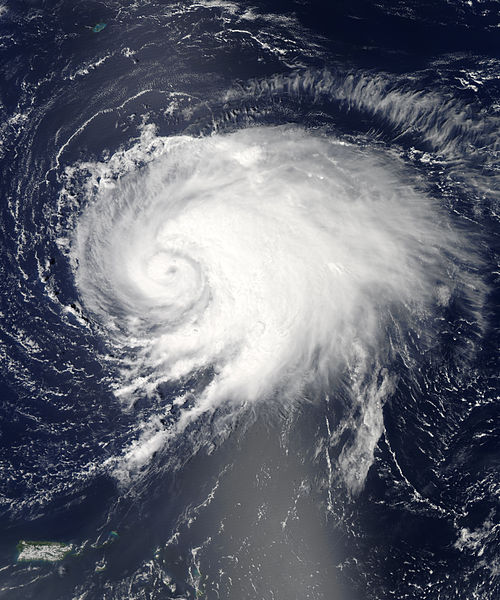
This time-lapse animation shows the evolution of Gonzalo (viewed in infrared, but overlaid on the Blue Marble) from midday on October 13 to midday on October 17, 2014. Images were acquired by the GOES-East geosynchronous weather satellite, which was built by NASA and is operated by the National Oceanic and Atmospheric Administration. Read more at http://earthobservatory.nasa.gov/IOTD…
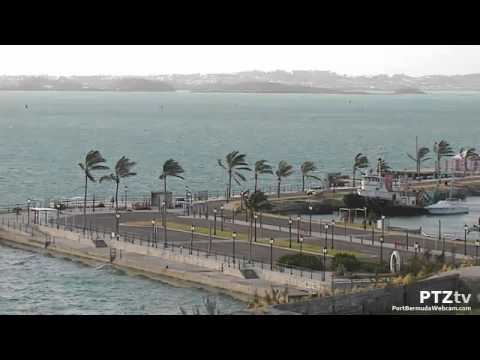
LIVE video & sound captured by the Port Bermuda Webcam located on the Commissioner’s House at the National Museum of Bermuda in Royal Naval Dockyard. Port Bermuda Webcam – http://www.PortBermudaWebcam.com National Museum of Bermuda – http://www.bmm.bm/ Royal Naval Dockyard Bermuda – http://www.thewestend.bm/
Live footage recorded from the Port Bermuda Webcam as Tropical Storm Gabrielle thrashes the Royal Naval Dockyard Bermuda with strong winds and driving surf just after 7pm local time. Norwegian Cruise Line’s Norwegian Dawn cruise ship opted to stay in port for the night rather than venture out to sea.
Live webcam coverage was rolling as Willy & Team battled the wind and waves at Heritage Wharf in Bermuda during the departure of NORWEGIAN DAWN on 9/10/2013.
The departure was eventually aborted due to unsafe weather conditions.
Port Bermuda Webcam is a 24/7 live streaming Internet video broadcast produced by PTZtv in association with the National Museum of Bermuda and North Rock – Logic Communications.
Tropical Storm Leslie passed Bermuda around noon (local time) on Sunday, 9/9/12, bringing winds no stronger than many winter storms experienced on the island. BIOS and the R/V Atlantic Explorer all fared well!
Channel 82 Bermuda streamed Leslie’s passing live from Scaur Hill, Sandys.
Sunday Sept 9, 2012
Winds have been sustained tropical storm force, gusting hurricane force across elevated and exposed areas of Bermuda. Showers, with a chance of thunder remains as Leslie moves northward. Winds will slowly begin to decrease early this evening as Leslie accelerates north-northeast and strengthens. Hazardous surf and rip currents continue into Monday.
As of the 6 p.m. advisory, TS Leslie is located 151 nautical miles to Bermuda’s ENE and a Tropical storm force winds will continue to affect the eastern marine area until 9pm. A Tropical Storm Warning remains in effect but is likely to be discontinued for the 9pm Intermediate National Hurricane Center advisory.
Minister Perinchief : “ …it will be business as usual tomorrow!”
KEY: Blue = 34-50 kts, Yellow = 50-64 kts, and Red = 64 kts and greater
Diagonal shading indicates fringe winds (34kts or greater surrounding the storm’s core)
28Storms.com Sept 5,Wed. Night Leslie & Isaac Discussion
Sept 8, 2012 6PM ADT
The latest forecast from the Bermuda Weather Service (BWS) shows that Leslie remains a Tropical Storm. However, the latest information from the Bermuda Weather Service (BWS), in consultation with the National Hurricane Centre in Miami, is that Leslie is expected to intensify into a Category 1 Hurricane as it passes Bermuda within the next 24 hours.
Sept 7 – Leslie is weakening, after days of stalling and slow movement in the Atlantic ocean. Nevertheless, the storm is expected to re-attain hurricane status as it passes Bermuda, and the island is currently under a Tropical Storm Watch.
=====
Leslie intensified into a hurricane Sept 5 while edging its way northward in the open Atlantic, on a direct path for Bermuda. Leslie is expected to become a Category 2 storm.
Tropical storm force winds are expected Sunday morning, with storm to possibly hurricane force gusts Sunday morning through afternoon. Hazardous surf and rip currents continue through Sunday
=====
Sept 5
Leslie intensified into a hurricane today whilst edging its way northward in the open Atlantic, aiming for Bermuda at present. Leslie is expected to become a Category 2 storm, with a small chance of the storm becoming the first major hurricane of the Atlantic season. All interests in Bermuda should be monitoring this storm, as it is expected to pass close to the island in the next three days.With winds of 65 mph, the circulation of Leslie looks like it is experiencing some shear with most of the activity on the right side. That is the side forecast to hit Bermuday by the end of the week.
Sept 4
Leslie is starting its major slowdown over the Atlantic and the convection of Leslie appears to be heading towards Bermuda. Why is this circulation moving so slowly? Will the atmosphere keep Leslie at bay?
Tropical Storm Leslie has been churning the open Atlantic waters on its journey northeastward. Leslie is expected to continue to stay away from North America, though the Bermuda Weather Service refers Leslie as a potential threat to the island .
Leslie has attained 70mph winds and a pressure of 994mb earlier in its lifetime.
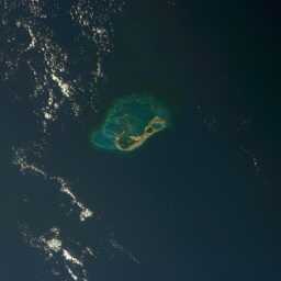
By LANCE MODIS Rapid Response Team, Goddard Space Flight Center. Caption by Michon Scott. [Public domain], via Wikimedia Commons
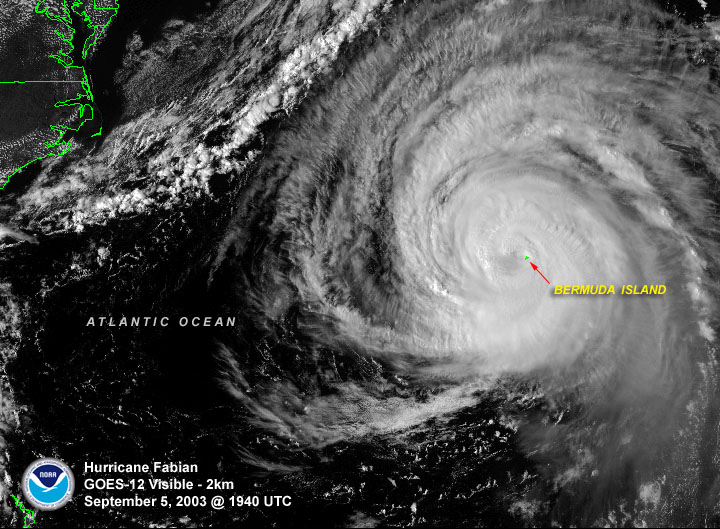
Category 3 Hurricane Fabian Strikes Bermuda in September 2003. The strongest hurricane to hit Bermuda since Hurricane Arlene in 1963.
Extreme Storms cameraman Jim Edds journeys to Bermuda to capture the worst hurricane to hit since 1926. A fully edited documentary with interviews with survivors. Great viewing for all ages. A Science and Geography lesson for all ages. Video shot by Jim Edds of extremestorms.com
Hurricane Fabian was making landfall over Bermuda on September 5, 2003 when this image was taken. At the time it was a major hurricane packing winds of 120 mph. NOAA / National Climatic Data Center – http://www1.ncdc.noaa.gov/pub/data/images/hurr-fabian-20030905-1940utc-g12vis.jpg
From September 17th – 20th, storm chaser Michael Laca intercepted Hurricane Igor on the island of Bermuda.On September 6th a large and complex area of disturbed weather associated with a tropical wave, moved off the west coast of Africa attended by two distinct areas of low pressure.The dominant low passed to the south of the Cape Verde islands while steadily increasing in organization, becoming a tropical depression on the morning of September 8th and reaching tropical storm strength later that day.For the next couple of days, Igor moved westward reaching hurricane strength late on September 11th. Rapid intensification ensued on September 12th and by late that afternoon, Hurricane Igor reached category four strength with maximum sustained winds of 135 mph (115 kts). An ERC (eyewall replacement cycle) began on September 13th which resulted in a slight weakening, followed by a new period of intensification, culminating in Hurricane Igor’s peak intensity, with the storm producing maximum sustained winds of 155 mph (135 kts) and a minimum central pressure of 925 mb (27.32 mb) late on September 14th. During this time, Hurricane Igor was very near category five intensity After reaching its peak, Hurricane Igor turned toward the west-northwest and began a slow weakening process over the next few days with several additional ERCs observed. By September 16th, the hurricane had weakened to category three intensity while its windfield continued to expand. The weakening trend continued and by September 17th Igor was downgraded to a category two while turning more towards the northwest.
On September 18th, extremely large Hurricane Igor continued to weaken while turning more towards the north. Although weakening, the storm’s massive windfield was producing hurricane conditions outward as much as 105 miles from the storm’s center, with tropical storm force winds extending out near 350 miles. Tropical storm conditions spread across Bermuda by the early morning hours of September 19th and continued to worsen as the day progressed with hurricane conditions reaching the island shortly after nightfall. As Hurricane Igor approached Bermuda, the storm began moving more towards the north-northeast, making its closest point of approach near 11:00pm AST (0300 UTC) while passing 40 miles west of the island. At this time, Igor was a category one hurricane with sustained winds of 75 mph (65 kts) and a minimum central pressure of 955 mb (28.20 in).
With the exceptionally large windfield that Hurricane Igor produced, impacts on Bermuda began well before the core of the storm approached the island. On September 17th, more than two days prior to Igor’s closest approach, large and damaging waves had already reached south facing beaches along the island with several cliff side roadways experiencing overwash from breaking wave crests. Wave heights continued to increase on September 18th with exposed sections of the island’s South Road becoming impassable as huge waves crashed onshore.
By the early morning of September 19th, with Hurricane Igor still over 250 miles away, tropical storm conditions had spread across the island with gusts frequently exceeding 50 mph (45 kts) at my location in Hamilton Parish, on the northwest side of Castle Harbour. Conditions continued to deteriorate throughout the day with the onset of hurricane conditions occuring just after nightfall on the 19th. Peak conditions occurred from 10:00 pm to midnight AST, as Igor passed just to the west of the island. I estimate maximum sustained winds of 75 mph (65 kts) with gusts near 90 mph (78 kts) impacted my location. The minimum pressure I recorded at the Grotto Bay Beach Resort was 965.7 mb (28.52 in) at 10:55 pm AST during a period of rapid pressure fluctuations, followed by a temporary recovery to 983.3 mb (29.03 in) at 12:25 am on the 20th, and then a second minimum of 966.7 mb (28.55 in) at 3:25 am. Sustained tropical storm conditions impacted my location for approximately 36 contiguous hours.
The highest officially reported winds on Bermuda during Igor’s passage were 74 mph (64 kts) with a peak gust of 93 mph (81 kts) from the official weather observing site at L.F. Wade International Airport (approximately two miles east-northeast of my location). A peak gust of 89 mph (77 kts) was also observed from an elevated location on the island. The lowest official pressure on the island was 965 mb (28.50 in), though storm chaser Mike Theiss observed a pressure of 964 mb (28.47 in) at Elbow Beach.
Tropmet.comis a web destination dedicated to hurricanes, tropical cyclones, tropical meteorology, severe weather and storm chasing. The site is owned and maintained by veteran storm chaser, Michael Laca.